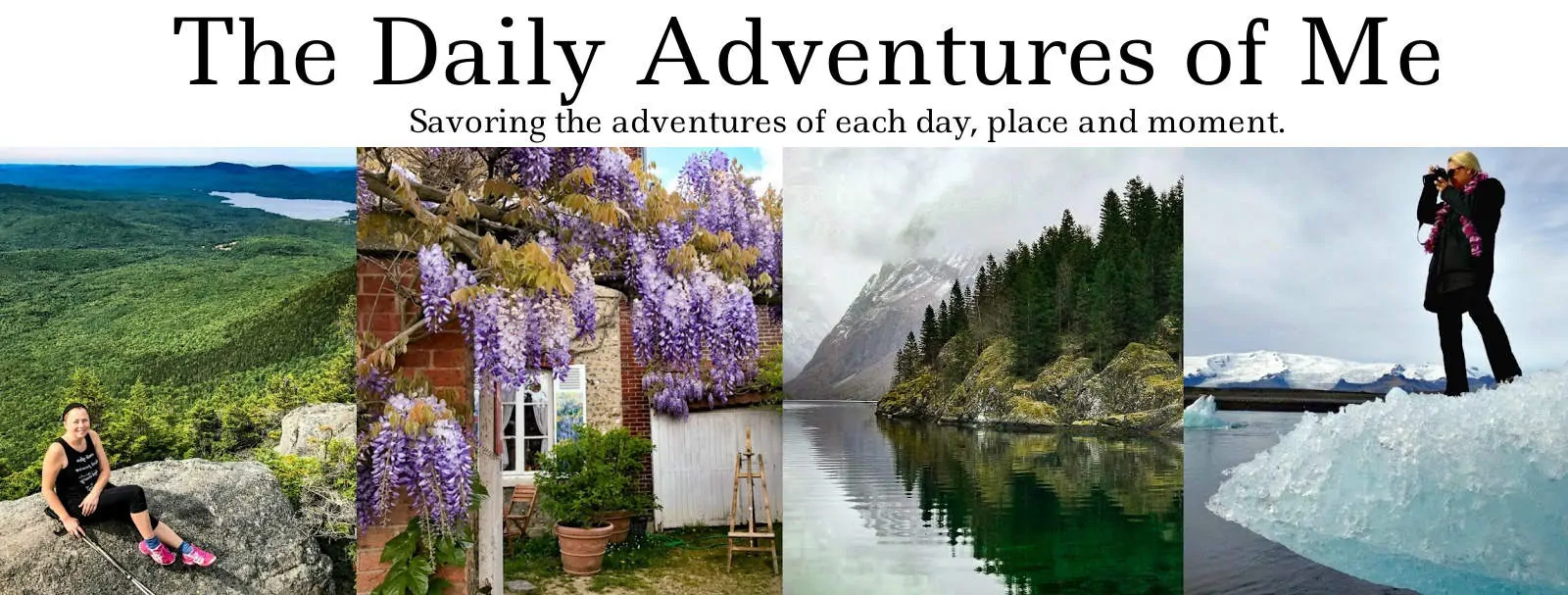
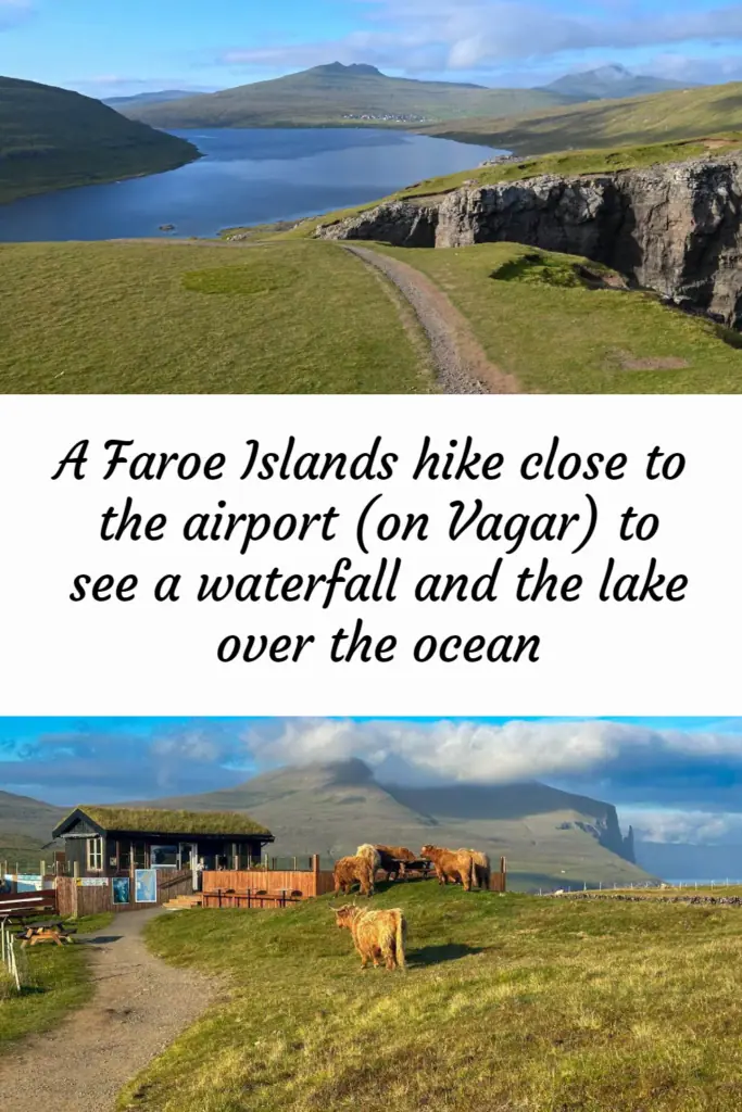
On day one of our eight-day exploration of the Faroe Islands, after visiting Gásadalur, we headed to see the famous lake over the ocean. Besides this optical illusion, this 3.7-mile round-trip hike has much to offer, including a beautiful lake and a waterfall that empties over a cliff into the Atlantic. And it is only about three miles from the Vagar Airport.
Lake Sørvágsvatn (or Lake Leitisvatn or Vatnið)
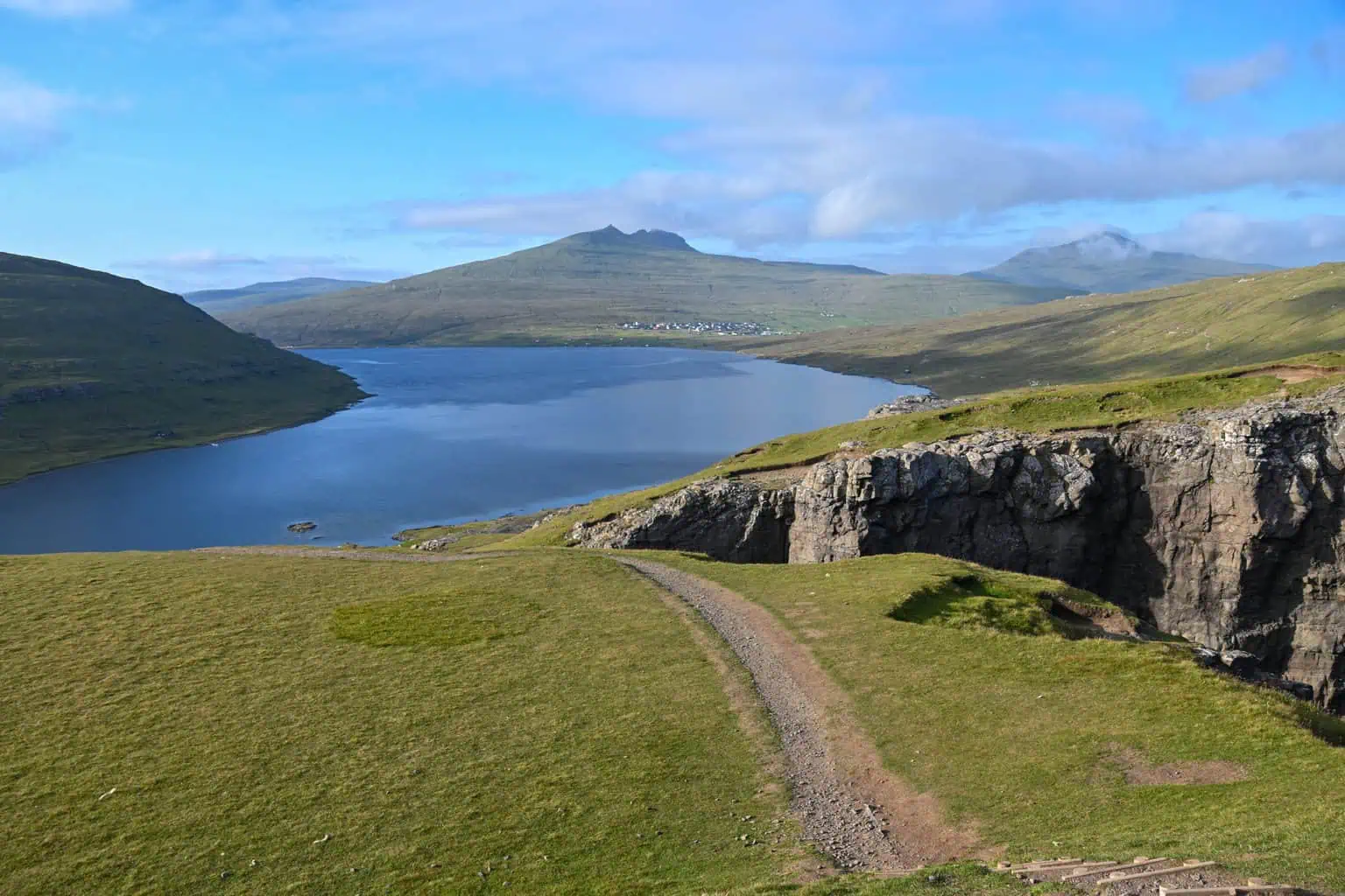
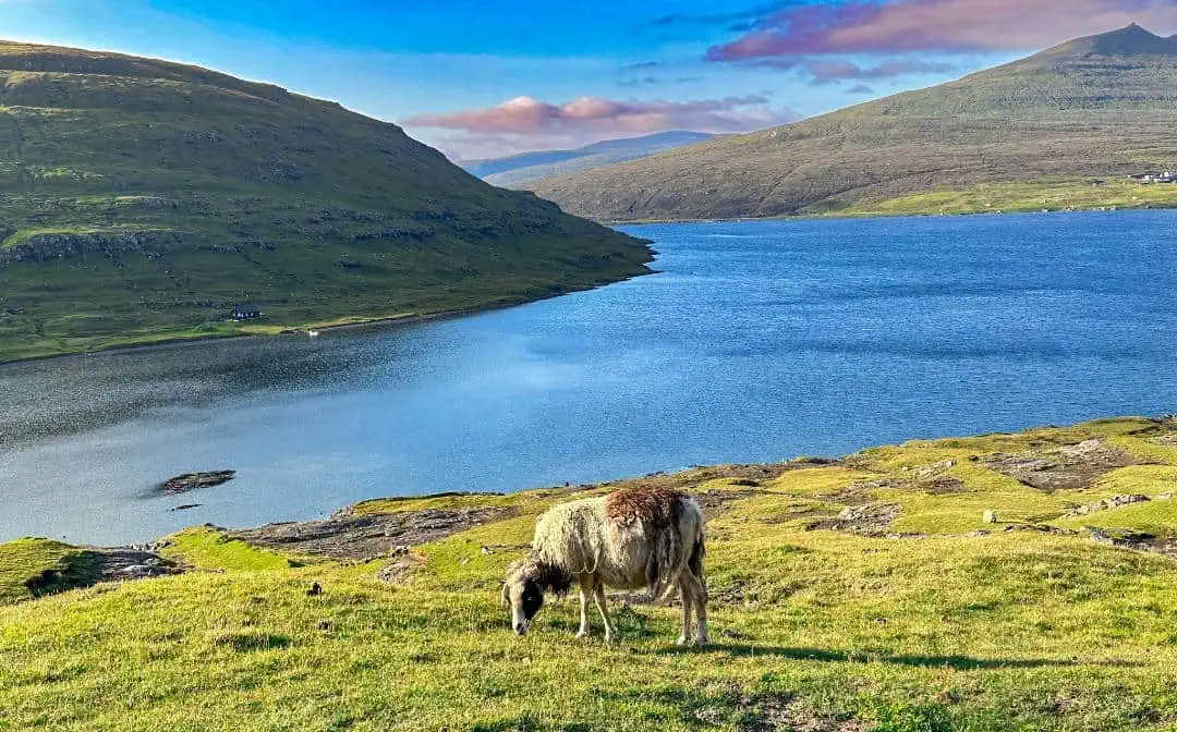
Why does one lake have three names? What you call the lake depends on where on the island you live, but no matter what you call it, this lake appears to be floating over the ocean from particular perspectives. It is the largest lake in the Faroe Islands and is separated from the ocean by a strip of land, although a small tributary flows into a waterfall.
How Long to Spend at Lake Sørvágsvatn
We only had a half-day to devote to this area, but you could easily spend a day here. We saw people camping along the lake’s southern shore, and kayaking is also available.
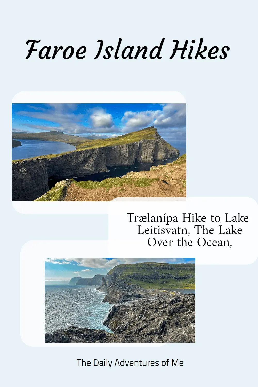
The Hike to Trælanípa
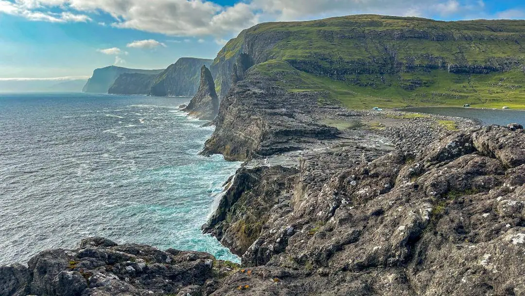
This hike heads to Trælanípa, which translates to Slave Cliff in English. In lore, old or sick enslaved people were thrown over this 142-meter-high (466-foot) cliff over the ocean.
The trailhead is in Miðvágur. It has a cafe (shown below), plenty of parking, and restrooms. You can pay the entrance fee to the trail in the cafe, which you can pay by cash or credit card.
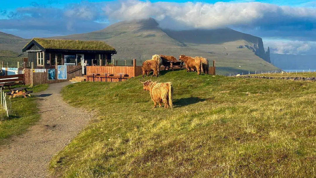
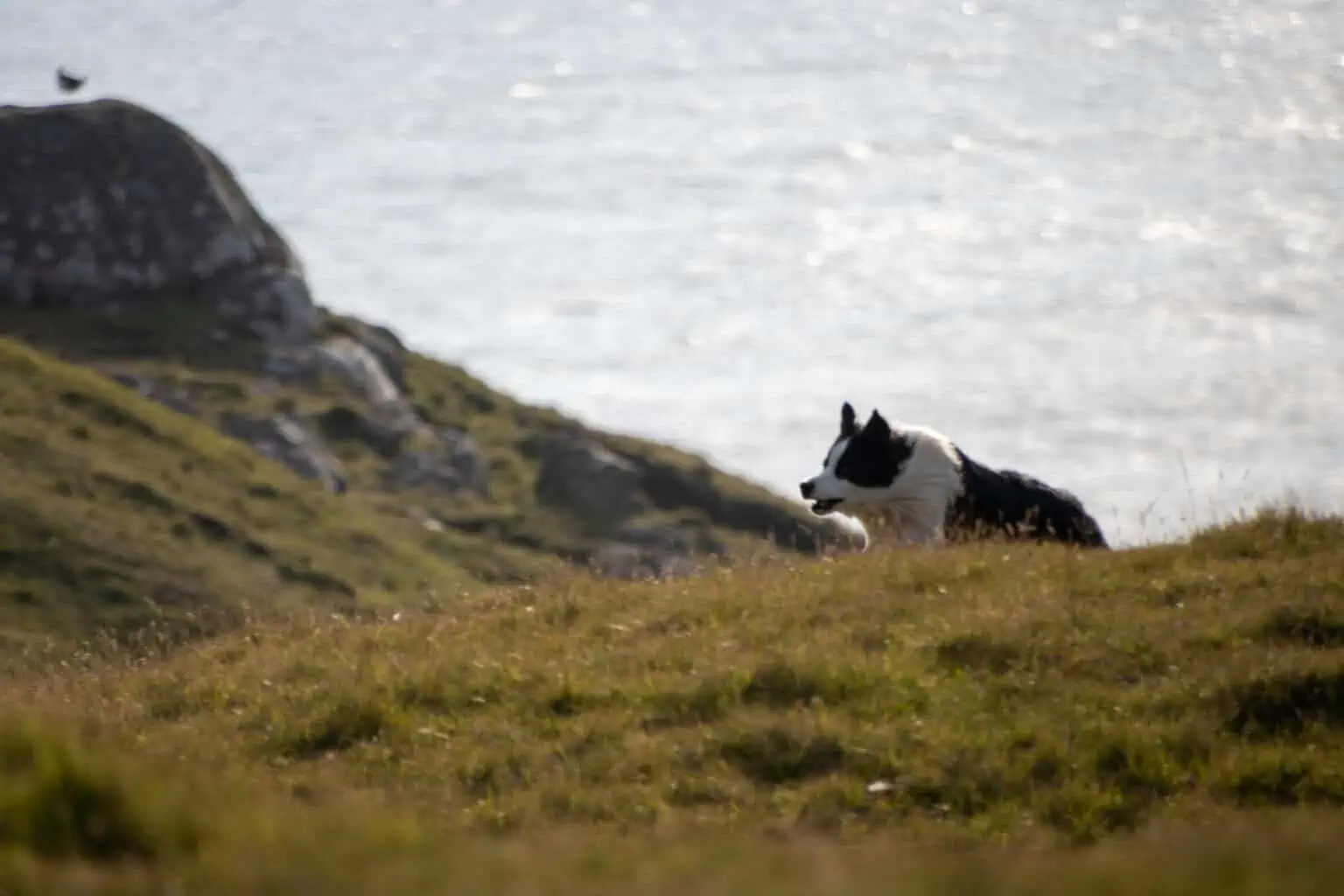
As soon as we entered the trail, we saw a group of Scottish Highland Cows. Along the trail, you will see many sheep. We also saw Faroese border collies working and a few wild hares.
For the first 2.7 km, you will travel on a flat gravel path following, but elevated from, the coastline of Lake Leitisvatn.
At this point, you will have choices. We veered off to the right to head to the shore of Lake Leitisvatn so we could see the water become the waterfall. The trail became much less noticeable, although construction of a new path was going on when we were there.
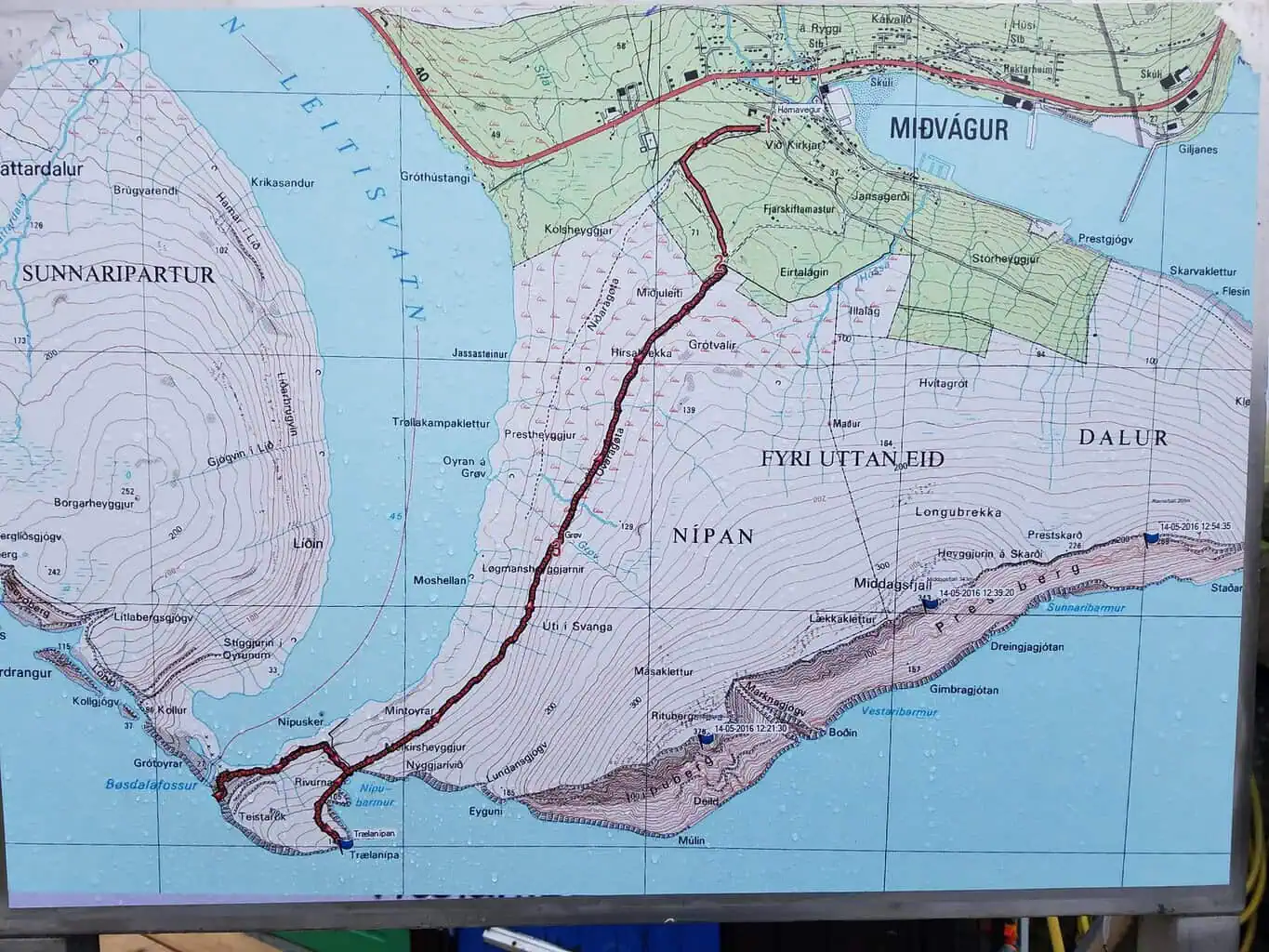
A map of the Lake Sørvágsvatn hike to Slave Cliff. If you want to go directly up to the cliff, just stay straight on the path.
Bøsdalafossur
The lake turns into a smaller river, which ends in the 30 m waterfall, Bøsdalafossur. Most people did not take a chance to explore this area and instead headed left at the fork to head straight up to the top of Slave Cliff.
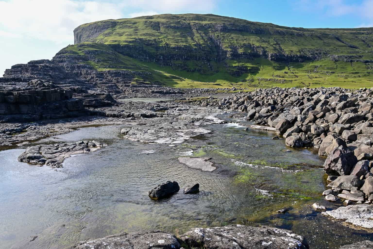
You cannot see much of the waterfall from where it plummets into the ocean, but decent views can be seen if you head straight up the rocky mountain toward the cliff. On this steep hike up the mountain, I also saw a few hares.
Slave Cliff
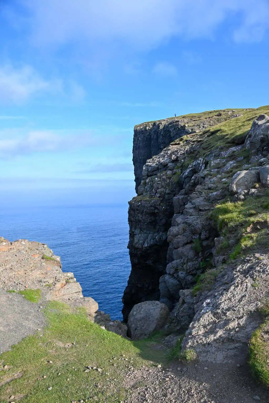
We then headed up to the top of the cliff, where we saw signposts denoting the best spots to view and photograph the lake’s optical illusion over the ocean.
The way down is steep and slippery, so reconsider visiting this area on a rainy day.
We then finished our hike and headed to our next destination, Gjogv.
This was one of our favorite hikes on the Faroes. Although we did it in about three hours, you could easily spend more time here. We also hiked longer than 3.7 miles as we ambled by the lake for a while. This is an excellent hike before or after visiting the airport.
Have you done this hike? Please add any other advice in the comments.
What an incredible adventure! The hike to Lake Sørvágsvatn sounds absolutely breathtaking, especially with the stunning views from Slave Cliff. I love how you described the unique optical illusion of the lake appearing to float over the ocean—definitely a sight worth seeing! The mix of nature, history, and the chance to spot Highland cows and local wildlife makes this hike even more special. Thanks for sharing your experience and tips.
The photos and detailed descriptions really make me want to pack my bags and head straight for the Faroes! It’s impressive that you covered so much in just half a day – that tip will help when planning my own itinerary. I can imagine the landscape changing with every step and season, and seeing Highland cows and Faroese sheep must be a delightful bonus!
To answer your questions: I haven’t done this hike yet, but your advice about allocating more time to explore and possibly kayak sounds perfect. I’d probably follow your lead and take the extra detour to see Bøsdalafossur! The steep, slippery descent you mentioned would also make me think twice about hiking in the rain – thanks for that heads-up!
Are you heading there soon? Enjoy your hike!
I’m hoping to make the trip soon, though no exact dates yet. Reading about it makes me more excited to plan 🙂